About RRVWSP
About the Project
The Red River Valley Water Supply Project (RRVWSP) will provide an emergency water supply to central and eastern North Dakota during times of water scarcity so as to protect public health, ensure ongoing economic vitality, and provide for environmental benefits in the river systems.
History
The Red River Valley Water Supply Project (RRVWSP) was first initiated as a federal project. The Dakota Water Resources Act (DWRA) of 2000 authorized the RRVWSP in order to provide a reliable supply of quality drinking water for the Red River Valley. The need for the project arose from the drought-prone Red River and supported studies that show a severe drought, similar to that of the 1930s, will likely repeat by the year 2050. If this were the case, water supplies in the Red River Valley would be insufficient. The DWRA also mandated the preparation of an Environmental Impact Statement (EIS) with joint leadership between the federal government and the State of North Dakota. Garrison Diversion was designated by the governor to represent the State of North Dakota in the RRVWSP.
Garrison Diversion (representing the State of North Dakota) and the Bureau of Reclamation (representing the federal government) were co-leads in the development of the EIS. The purpose of the EIS was to evaluate alternatives to meet the long-term water needs of the Red River Valley in North Dakota and three border cities in Minnesota; East Grand Forks, Moorhead and Breckenridge. In 2007, the final version of the EIS was released.
In accordance with the DWRA, the Bureau of Reclamation sent a comprehensive report for the proposed project to Congress on December 5, 2008. The report identified the selected alternative, environmental issues, effects on Minnesota and Missouri River states and compliance with the Boundary Waters Treaty. Their proposed project identified by the Secretary of Interior was the Garrison Diversion Unit (GDU) Import to the Sheyenne River Alternative. This was the preferred alternative of the Bureau of Reclamation, State of North Dakota and the Lake Agassiz Water Authority (LAWA) in 2008.
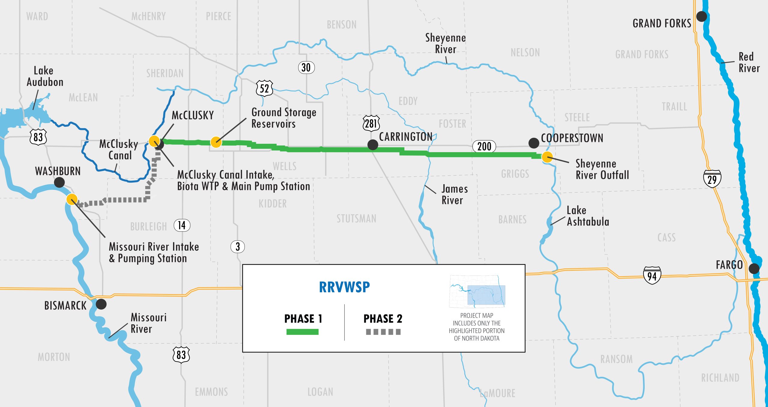
The original Red River Valley Water Supply Project (RRVWSP) was conceived as a federal, state and local project. Without federal authorization in place, local leaders and stakeholders began to look for a state and local option to complete the highly needed project. After completing multiple studies and examining countless alternatives, a route for the RRVWSP was determined. The project will bring Missouri River water from the McClusky Canal in central ND, to the Sheyenne River, closely running along the Hwy 200 corridor in central ND.
The route for the RRVWSP is flexible, environmentally friendly and reliable. The route is adaptable to different growth patterns, and the Sheyenne and Red Rivers provide increased water delivery capacity to the systems compared to a pipeline. Using the river conveyance will enhance return flow capture allowing reuse of the RRVWSP water. This route also provides benefits to the aquatic environment of fish, mussels and the riparian habitat. There are minimal impacts on the Missouri River using this supported route, and it’s reliable. This route utilizes Lake Ashtabula as a storage reservoir, state-of-the-art water treatment plants that currently exist in the Valley and will continue to be used, and supplemental water supply that will not add to Baldhill Dam Sheyenne River flooding.
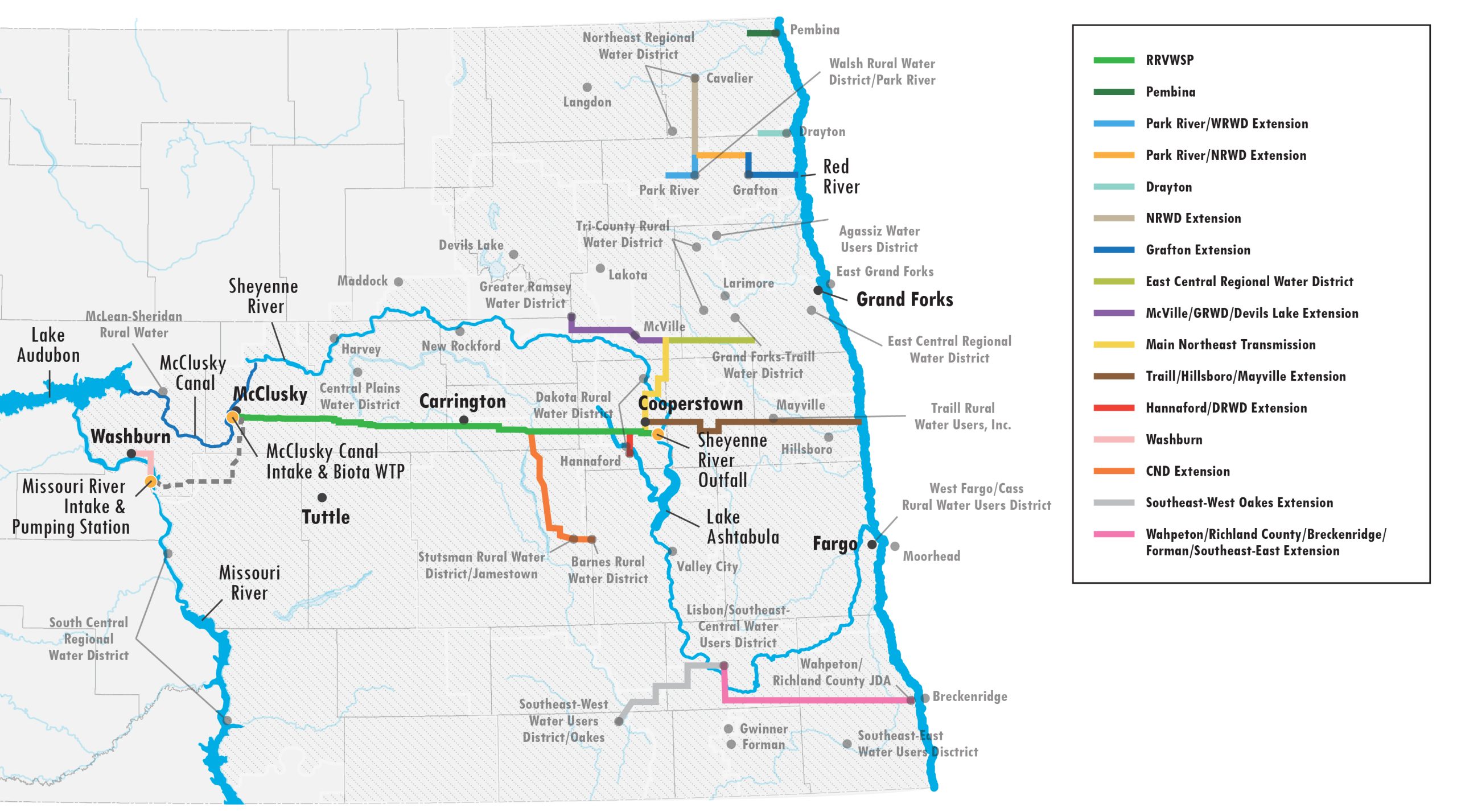
The RRVWSP was expanded to include central North Dakota, in response to the 2015 legislative session. The state and local project version of the RRVWSP will benefit users along the pipeline route throughout central North Dakota and ultimately the Red River Valley, providing an advantage over the original federal project, as that only served users in the Red River Valley.
January 15, 2021 – A Record of Decision (ROD) is signed, approving the Eastern North Dakota Alternate Water Supply (ENDAWS) following the 30-day waiting period after the U.S. Department of the Interior’s Bureau of Reclamation (Reclamation) issued a Final Environmental Impact Statement. ENDAWS is an alternate bulk water supply to the state Red River Valley Water Supply Project (RRVWSP). The signed ROD authorizes the use of 145 cubic feet per second (cfs) of water from the McClusky Canal for ENDAWS. The ability to utilize the McClusky Canal as an alternate water source for the RRVWSP will save millions in construction costs, as well as millions in operations and maintenance costs.
Why Is It Needed?

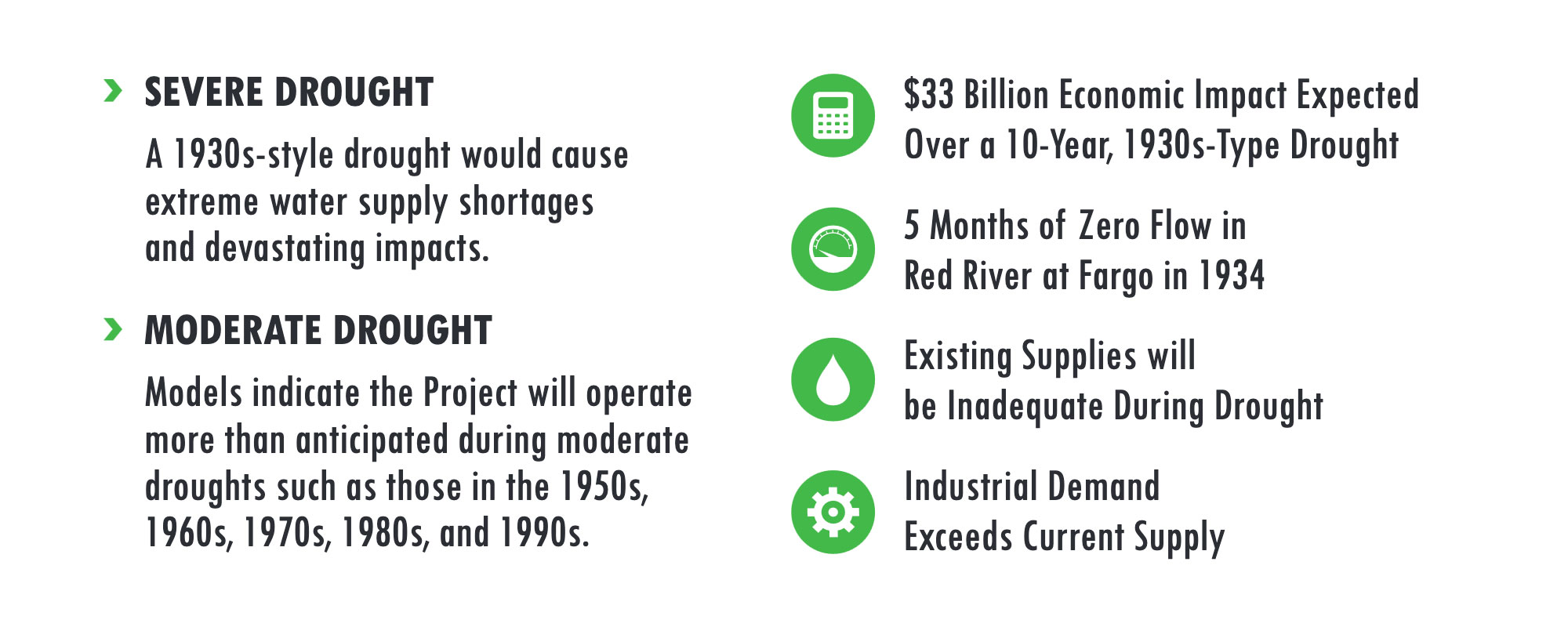
The need for the Red River Valley Water Supply Project (RRVWSP) arose from the drought-prone Red River and supported studies that show a severe drought, similar to that of the 1930s, will likely repeat by the year 2050. Surface water supplies in Central North Dakota and the Red River Valley are limited and unreliable, particularly under drought conditions. Existing supplies are inadequate for a drought. Additionally, limited groundwater supplies are nearly fully appropriated. With continued growth and industrial development, the RRVWSP is needed to mitigate against drought conditions that would cause costly water shortages, foster economic development by meeting municipal, industrial and rural water demands, and promote environmental sustainability. The industrial need is becoming more dynamic in North Dakota over time, not less.
The RRVWSP is necessary to protect our communities and economy from the devastating effects of drought. The estimated financial impact of a drought similar to the one Fargo, North Dakota experienced in the 1930s is $33 billion (2021$) over a ten-year period. In addition, State law discourages the conversion of groundwater irrigation to drinking water. The emergency water supply to central and eastern North Dakota during times of water scarcity will protect public health, ensure ongoing economic vitality, and provide for environmental benefits in the river systems.
Pipeline Route
The Red River Valley Water Supply Project (RRVWSP) will use a buried pipeline to carry water from the McClusky Canal in central North Dakota, along Highway 200 to the Sheyenne River north of Lake Ashtabula, which will provide a supplemental and emergency water supply to users in central and eastern North Dakota. Water will be treated before crossing the continental divide.


